

Zenmuse L1 – LiDAR Camera Fashion
Description
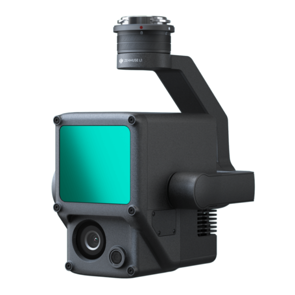
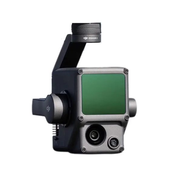
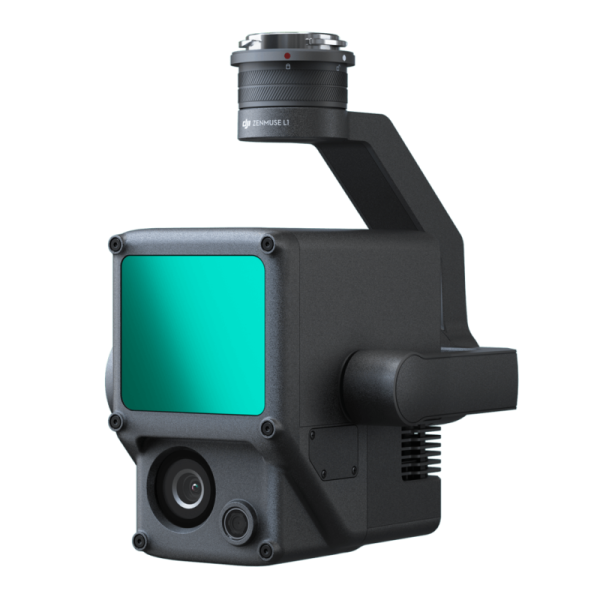
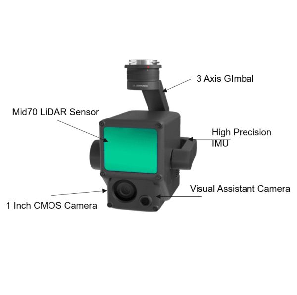
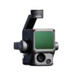
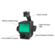
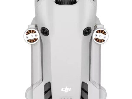
Zenmuse L1 Lidar
The Zenmuse L1 integrates a Livox Lidar module, a high-accuracy IMU, and a camera with a 1-inch CMOS on a 3-axis stabilized gimbal. When used with Matrice 300 RTK and DJI Terra, the L1 forms a complete solution that gives you real-time 3D data throughout the day, efficiently capturing the details of complex structures and delivering highly accurate reconstructed models.
* Desktop and larger screens *
.video-container {
display: flex;
gap: 20px; * Space between videos *
justify-content: space-between;
}
.video-frame {
flex: 1 1 48%; * Each video takes 48% width, leaving space for the gap *
aspect-ratio: 16 9; * Maintain aspect ratio for videos *
border: none;
}
* Mobile view *
@media (max-width: 768px) {
.video-container {
flex-direction: column; * Stack videos vertically *
}
.video-frame {
flex: 1 1 100%; * Full width on mobile *
margin-bottom: 20px; * Space between stacked videos *
}
}
The DJI Zenmuse L1 stands as a pioneering integration of lidar and RGB technologies, meticulously designed to cater to a wide range of applications such as surveying, construction, and agriculture, among others. Here’s an expanded overview of its features:
🌐 Advanced Lidar Module Integration: At its core, the L1 features a sophisticated Livox lidar module that excels in capturing high-fidelity three-dimensional environmental data. This capability enables users to conduct precise and detailed mappings of complex terrains and structures, facilitating a deeper understanding of the surveyed areas.
📸 High-Resolution RGB Camera: Accompanying the lidar module is a high-resolution RGB camera that captures vivid, true-to-life color images. This feature is essential for generating colorized point clouds and photorealistic models, providing a rich visual context to the structural data captured by the lidar sensor.
🔄 High-Accuracy IMU Integration: The inclusion of a high-precision Inertial Measurement Unit (IMU) enhances the system’s ability to accurately track and record the drone’s movements in real-time. This integration significantly improves the overall accuracy of the data collected, ensuring reliable and consistent results.
🛰️ Robust GNSS Module for Precise Geotagging: Equipped with a Global Navigation Satellite System (GNSS) module, the L1 guarantees precise geolocation tagging of lidar data, a critical aspect for mapping and surveying applications that demand high positional accuracy.
🌦️ Designed for All-Weather Performance: The L1 is engineered to withstand various environmental conditions, making it a resilient tool for data collection in challenging weather scenarios, thereby ensuring operational continuity and data reliability.
🔄 Comprehensive 360-Degree Environmental Data Capture: Thanks to its lidar sensor’s 360-degree coverage, the L1 is capable of capturing exhaustive environmental data without leaving any blind spots, ensuring a complete and accurate representation of the surveyed area.
🔒 Secure Data Transmission Protocols: The system is designed with advanced data transmission security measures, safeguarding sensitive information during the collection and transmission of critical mission data.
📊 Real-Time Point Cloud Visualization: A standout feature is the Point Cloud LiveView, which provides operators with a real-time visualization of point cloud data during flight operations. This immediate feedback allows for on-the-spot insights and decision-making, enhancing mission efficiency.
📈 Seamless DJI Terra Software Integration: The L1 is fully compatible with DJI Terra, DJI’s proprietary data processing software. This compatibility streamlines the post-flight data processing workflow, enabling the efficient generation of detailed 3D models and comprehensive accuracy reports.
🔄 User-Friendly Quick-Release Design: Featuring a practical quick-release design, the L1 can be easily attached to or detached from compatible DJI drones. This design facilitates swift deployment and enhances the versatility of the payload across various missions and applications.
💡 Enhanced Night Operation Capabilities: The L1 is adept at capturing high-quality data in low-light conditions, expanding the operational capabilities of users to conduct night-time surveys and inspections.
🌍 Broad Application Spectrum: From surveying and construction to agriculture, the Zenmuse L1 provides professionals across industries with a dynamic tool for capturing detailed environmental data, supporting informed decision-making and enhancing project outcomes.
The Zenmuse L1 embodies DJI’s commitment to innovation in aerial surveying technology, offering an unmatched blend of lidar and RGB imaging capabilities that set a new standard for accuracy, efficiency, and versatility in professional aerial data collection.
Measurement and Annotation
The capability to acquire and communicate critical dimensions directly within the point cloud model significantly enhances the precision and clarity of spatial data analysis. By utilizing measurements and annotations, users can not only determine the exact dimensions of objects and spaces within the model but also effectively convey this information through detailed notes and markers. This process not only streamlines workflow by allowing for the direct application of analytical data but also facilitates clear communication among team members or stakeholders, ensuring everyone has access to accurate, actionable insights. Such functionality is indispensable in fields like construction, architecture, and urban planning, where precise measurements are crucial for project success.
* Desktop and larger screens * .video-container { display: flex; gap: 20px; * Space between video and text * justify-content: space-between; } .video-frame { flex: 1 1 48%; * Each video takes 48% width, leaving space for the gap * aspect-ratio: 16 9; * Maintain aspect ratio for videos * border: none; } .text-container { flex: 1 1 48%; * Take up the same space as video * padding: 20px; background-color: transparent; * Set background to transparent * border: none; * Transparent border * } * Mobile view * @media (max-width: 768px) { .video-container { flex-direction: column; * Stack videos and text vertically * gap: 10px; * Reduced space between elements * padding: 10px; * Add padding for mobile devices * } .video-frame { width: 100%; * Full width on mobile * margin-bottom: 20px; * Space between stacked elements * } .text-container { width: 100%; * Full width for text on mobile * margin-bottom: 20px; * Space between stacked elements * padding: 15px; * Adjust padding on mobile * background-color: transparent; * Set background to transparent * } }
Point Cloud Live View
The advent of real-time point cloud technology marks a significant leap forward in operational efficiency and decision-making capabilities on-site. This innovation allows operators to gain instant insights into the surveyed area, equipping them with the necessary information to make pivotal decisions swiftly and with confidence. Additionally, the ability to verify the quality of fieldwork instantaneously by examining point cloud data right after a flight ensures that any necessary adjustments or re-flights can be identified and implemented promptly. This immediate feedback loop not only enhances the accuracy and reliability of the data collected but also significantly streamlines project workflows, reducing delays and improving overall project outcomes.
Related products
DJI Mini 3 Combo Drone 4K HDR, with RC-N1 Remote Fly More Combo (3 Batteries, Charging Hub and Remote Kit) For Cheap
Original price was: $83,949.00.$25,184.70Current price is: $25,184.70.
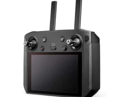
DJI Smart Remote Controller For Air2, Air2S , Mavic 2 pro Zoom, Mavic 2 Enterprise Dual Advance Discount
Original price was: $57,500.00.$17,250.00Current price is: $17,250.00.
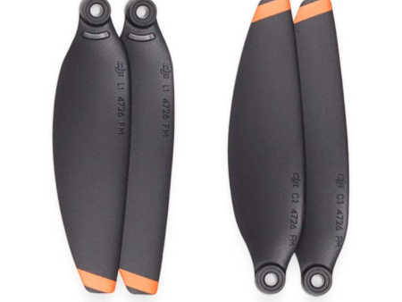
Propellers Set for DJI Mini 2 Mini 2 SE Fashion
Original price was: $3,425.85.$1,027.76Current price is: $1,027.76.
DJI Mini 4 Pro Drone (Only Body) Sale
Original price was: $87,399.00.$26,219.70Current price is: $26,219.70.
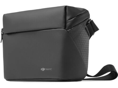
DJI Carry Bag for Mini 2 Mini 2 SE & Mini 3 with Shoulder Strap For Cheap
Original price was: $6,381.35.$1,914.41Current price is: $1,914.41.
Information
Customer Care
Other Business
Newsletter

* Desktop and larger screens * .video-container { display: flex; gap: 20px; * Space between video and text * justify-content: space-between; } .video-frame { flex: 1 1 48%; * Each video takes 48% width, leaving space for the gap * aspect-ratio: 16 9; * Maintain aspect ratio for videos * border: none; } .text-container { flex: 1 1 48%; * Take up the same space as video * padding: 20px; background-color: transparent; * Set background to transparent * border: none; * Transparent border * } * Mobile view * @media (max-width: 768px) { .video-container { flex-direction: column; * Stack videos and text vertically * gap: 10px; * Reduced space between elements * padding: 10px; * Add padding for mobile devices * } .video-frame { width: 100%; * Full width on mobile * margin-bottom: 20px; * Space between stacked elements * } .text-container { width: 100%; * Full width for text on mobile * margin-bottom: 20px; * Space between stacked elements * padding: 15px; * Adjust padding on mobile * background-color: transparent; * Set background to transparent * } }
Point Cloud Live View
The advent of real-time point cloud technology marks a significant leap forward in operational efficiency and decision-making capabilities on-site. This innovation allows operators to gain instant insights into the surveyed area, equipping them with the necessary information to make pivotal decisions swiftly and with confidence. Additionally, the ability to verify the quality of fieldwork instantaneously by examining point cloud data right after a flight ensures that any necessary adjustments or re-flights can be identified and implemented promptly. This immediate feedback loop not only enhances the accuracy and reliability of the data collected but also significantly streamlines project workflows, reducing delays and improving overall project outcomes.
Related products
DJI Mini 3 Combo Drone 4K HDR, with RC-N1 Remote Fly More Combo (3 Batteries, Charging Hub and Remote Kit) For Cheap
DJI Smart Remote Controller For Air2, Air2S , Mavic 2 pro Zoom, Mavic 2 Enterprise Dual Advance Discount
Propellers Set for DJI Mini 2 Mini 2 SE Fashion
DJI Mini 4 Pro Drone (Only Body) Sale
DJI Carry Bag for Mini 2 Mini 2 SE & Mini 3 with Shoulder Strap For Cheap
Information
Customer Care
Other Business
Newsletter
pathusstory.shop © 2025 All Rights Reserved
- Image
- SKU
- Rating
- Price
- Stock
- Description
- Weight
- Dimensions
- Additional information
- Add to cart